Wednesday 23 November 2011

Endurance Run 2 - The Glenridding Summit Circle

The Glenridding Summit Circle
  • Date  - 21st November, 2011
  • Location - Glenridding Youth Hostel - Lake District
  • Total Distance - 12.29 Miles
  • Total Running Time, including Stoppages for Photographs - 04:23:31
  • Total Ascent - 1057 Metres
  • Total Decent - 1087 Metres
  • Total Calories Burned - 1591
The above information was taken from my Nike Runmeter and Garmin Vista GPS.

Disclaimer: I take no responsibility for any unfortunate errors made during writing this post.  This run has been completed by myself, with my best of knowledge and ability in recalling the entire route.
Recommendations: -In advance of undertaking this running route, I would recommend that the runner undertakes the following; Research the Route, Run with a Partner, Take an Ordnance Survey Map, Compass, Whistle, Waterproof Clothing, Nutrition, Survival Bag, Mobile Phone and completes a Route Card.
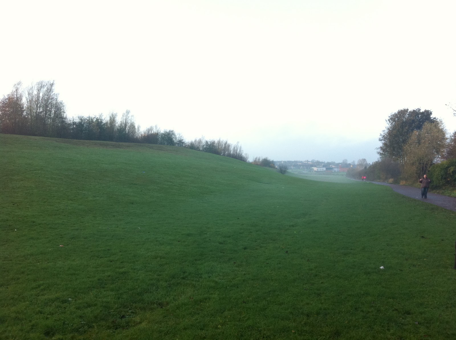
Starting Point – Glenridding Youth Hostel – Lake District
Swart Beck can be seen on the right of this photograph.
After parking the car outside the Youth Hostel and making my way over the footbridge towards Stang End. Witnessing the intense power of the water falling down from Swart Beck.
Passing the weir on the left and picking up the trail on my right. With a short but steep ascent passing Stang End on the left, the disused Mine & Lucy’s Tongue on my right. Crossing over the foot bridge and taking the track on my left.
The track starts to stabilize enabling me to zone in to a moderate pace, heading up to Sticks Pass with the Ski Tow on my left, Green Side and Sty Barrow Dodd on my right.

At the head of Sticks Pass where several tracks cross over, taking the track on the right to reach the summit of “Raise”.


At the cairn on the summit of the “Raise”
After a quick slice of "Cherry Fruit Cake" which I purchased earlier, from a roadside mobile food van. I progress forward with my run, following the track towards the cairn near Whiteside Bank.
Whilst homing in on my next target “The Helvellyn”. The weather quickly closes in with high winds, low cloud, poor visability and drizzle. Now the run gets more interesting!!!
After a long and steep ascent through the mist reaching my target, the "Trig Point" on the summit of the Helvellyn. Then heading west and passing Striding Edge on my left, which I can not see as it is masked by the mist. Being careful here, as the track splits in to two tracks. Which I chose to take the track on my left heading up and over “Nethermost Pike & Dollywaggon Pike”.
The track starts its slippy decent caused by wet rock, winding down and reaching  “Grisedale Tarn”. What a beautiful sight!!!


After downing a "Banana and an Energy Gel". Then progressing on following the descending track down towards “Grisedale Forrest”. With the beauty of Tarn Crag, Falcon Crag and The Tongue looming in the back ground.

Avoiding the footbridge on my left, but still following the descending  track and passing the “Ruthwaite” Climbing Hut on my left. With Grisedale Beck on my left and the beauty of “St Sunday Crag” on my right. The track at Thornhow now changes into tarmac, where at this point I take the track on my left and heading up a very steep ascent to the entrants of Brownend Plantation. Where I enter through a wooden gate, which is on my left and I follow the track up towards “Lanty’s Tarn”.
Lanty’s Tarn
After downing a Tuna Sandwich, then progressing on following the track to exit “Lanty's Tarn” through a wooden gate towards Glenridding. The track gets rather muddy and slippy where careful attention of foot placement is required. Crossing the foot bridge over Miresbeck and taking the middle track heading towards the Glenridding Youth Hostel. With Blea Cove on your right and Glenridding Beck on your left. The track follows a long side a stone wall, where a view point of the Youth Hostel and Swart Beck can be found on your right. After crossing over the foot bridge and passing the Weir on your left, the run comes to an end back at the Youth Hostel.

Photograph of the Youth Hostel with Swart Beck on the right

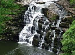
A close up photograph of Swart Beck

I would like to take this opportunity to thank my running buddy David - H, for introducing me to this wonderful location and interesting run.
Now it's time for a well earned beer!!!

 
“Keep on Running”

  Darren Barnes
  Follow my running activities on Twitter @enduranceruner

Wednesday 16 November 2011

Endurance Run 1- The Sunderland 4 Peak Challenge

The Sunderland “4 Peak” Challenge.
Distance: 20.8 Miles

Running time 4:30 minutes.
Total Ascent: 635 Metres
Total Decent: 702 Metres
“Putting the City of Sunderland, on the UK map for great off road running”.
It was Saturday 12th November at 8am straight after a healthy Shepherd’s Pie for my breakfast, I started my run. The temperature was about 8*C with mist and drizzle making the trails, muddy and very slippery, which only makes the run even  more interesting and fun.  As the morning progressed the sun started to peak through the clouds and the rain quickly cleared up.
Peak 1 – Tunstall Hill


The first peak of the morning run was Tunstall Hills, where on approach a short scramble to the top of the hill reaching the “trig point”. Turning 90* picking up the track and heading in a north easterly direction towards the village of Ryhope. The track gets a little tricky in a couple of places, where good under footing can prevent embarrassing falls. “Whoops” I missed my footing and fell, lying in the mud with two pulled inner thigh muscles. Never mind, after picking myself up and with a little stretching I pushed on with my run.


At the bottom of the track crossing over a small stream, I picked up a steep and very muddy grass bank, following the track running behind “Venerable Bede” secondary school.


Carrying along the track, where I meet with another steep and very muddy grassy bank, at the foot of the bank it meets up with the old coal railway line.


Heading west along the railway line for about 1 mile to meet the 2nd Peak of the run. The Silksworth Ski Slope, which is located at the Silksworth Sports Complex.


Peak 2 – Silksworth Ski Slope
Distance: 3 Miles.

Running to the top of the Ski Slope touching the fence and back down the other side, meeting up with the main walking path of the complex. Following the path in a semi circle direction passing Sainsbury’s Superstore which is now on your left and over a small footbridge. Turning left and following the path heading south. This is where I pick up another and challenging bank, which I decide to run up and down in a zigzag motion.
“I just love a Challenge”

Heading in a South direction, passing the Fire Station and McDonald's on the left. Just to tantalise your taste buds you can smell and imagine eating a Sausage & Egg McMuffin meal!!. However myself discipline to overcome such desires got the better of me. Still heading south you pick up the A690 which takes you out of Sunderland towards Stoneygate. Where after 6 miles, I turn left picking up the track and heading in a northern direction.


Where in the distance, I now I have in my sights my next Peak No 3– Hastings Hill.
Peak 3 – Hastings Hill
Distance: 8.5 Miles.

After a quick decent and crossing over the A19 bridge. Turning right, picking up the next track and heading west through Black Woods.


At the end of the trail the forest opens up leading in to New Herrington Park. Turning right and heading north to reach Peak No 4, Penshaw Monument.

Peak 4 – Penshaw Monument
Distance: 10.5 Miles

After a quick ascent to the top, turning left heading down some steep steps through a wooden gate heading east through the woods to meet up another steep back called Coxgreen Road. At the top of the bank heading in to Offerton Village, tuning left and ascending down another track meeting the River Wear. Turning right over the wooden sty and heading east following the river where at the 13th mile, the Wetlands wild foul can be found in abundance.


After passing under the A19 underpass, the runner passes by two pre-war vessels and the famous Clatchy Rock. This is the 15 mile marker, where the track heads up a grass bank, under the Metro railway bridge to meet up with the road B1405 – European Way.


Following the road and heading east in to the City of Sunderland town centre, passing the  B&Q retail shopping outlet on your left, this is the 17 mile marker. Turing right at the 2nd roundabout following the A183 – St Mary’s Way. Passing the Sunderland University on your left, crossing over the Metro railway line, under the A690 underpass, passing Burn Park on your left. Following the road A690 until reaching “The Barnes Toby Carvery” on your right. Turn left at the traffic lights, following Queen Alexandra Road. At the next roundabout turning right to pick up the short but steep “Strawberry Bank”. Near the top of the bank turning right heading along Crosslea Avenue, this is the 19 mile marker. At the bottom of the avenue turn left picking up Silksworth lane, where at the roundabout. Turn left heading east following Essen Way. Where at the bus stop turning right and entering the housing estate following Langley Drive, Witton Court, Harperley Drive and finishing the 20 mile run, with Tunstall Hills directly in front of you.

My recommendations
1.    Like most trail runs of this calibre, the runner will be exposed to both physical and mental stresses, going through the “hi and lows”. My recommendation to overcome this is purely down to good planning and preparation of nutrition and re hydration. It may be worth in considering to place a drop bag, just before reaching Peak – 4 Penshaw Monument.

2.    If you are lucky enough to own a smart phone such an "Iphone". Then I must recommend that you consider in purchasing the “Tune-in” Internet Radio App. During the course of the run between 9 am to 11:30 am, I was listening 97.3FM – Radio Brisbane – Australia “The Saturday Night Party Night”. This is a mixture of 80’s, 90’s and current music hits, well worth a listen!
The end of the run feeling good, while enjoying a bottle of Coca Cola
“Keep on Running”

  Darren Barnes
  Follow my running activities on Twitter @enduranceruner


Tuesday 8 November 2011

The Clyde Stride 40 Mile Ultra Marathon

Date: Saturday 16th July, 2011

Weather on the day: Dry, Scatted Clouds with an Average Temperature of Approximately 20*C.

The Clyde Stride 40 mile Ultra Marathon. Race six of the Montane Scottish Ultra Marathon Series.
The Clyde Stride follows the Clyde Walkway for approximately 40 miles, running in parallel with the river Clyde. It starts at Glasgow’s - Partick Railway Station following the river Clyde through Strathclyde Regional Park, the Unesco World Heritage Site at New Lanark and the Falls of Clyde Nature Reserve to finish at Bonnington Linn.
All runners have a time limit of 10 hours to compete the 40 mile distance. I did it in 8:59:33 seconds.
For further details of the Clyde Stride, please visit the following web site.


Section 1:  Partick to Cambuslang
Get Ready, Steady, 3, 2, 1 and there Off!
Photograph supplied by Mike Newton
Race briefing at Partick Railway Station Glasgow

Bothwell Castle
Bothwell is Scotland's largest and finest 13th century castle. It owes its origins to Walter of Moray, a northern aristocratic family who acquired Bothwell in 1242. He (or his son William, known as ‘the Rich’) created the mighty castle in a spectacular display of feudal pride.

Section 2: Cam buslang to Strathclyde Park
Check point 2 - Approximately the 20 Mile mark and feeling a little dehydrated. Flattened Coco Cola and a tube of Nutella, certainly does the trick and soon pulls me around.

Strathclyde Regional Park
An aerial view of Strathclyde Regional Park. The 1,000 acre Country Park has attractions that make it unique in Scotland, with all the facilities of the Watersports Centre from boat & cycle hire, sailing, and leisurely walks, to the exciting M&Ds - Scotland's Theme Park. Well worth a visit.


Section 3: Strathclyde Park to Maudslie Bridge
Some of the beautiful scenery that a runner will be succumbed too, while following the river Clyde. You have to be there to appreciate the beauty and tranquility that this route has to offer.


Check point 3 - Approximately the 30 Mile mark, feeling good and raring to push on!

Section 4: Mauldslie Bridge to New Lanark 
The Falls of Clyde Nature Reserve, where birdsong competes with the roar of the waterfalls, keep a look out for kingfishers, otters and badgers.


The finishing line
A last minute sprint over the finishing line, with a finishing time of (8:59:33) seconds. Not the fastest time, but at least I finished within the 10 hour window.
At the end of the race, I had a relaxing three hour drive back home to Sunderland in Tyne & Wear. While being dosed up with Coca Cola, Redbull and several Bananas. Two days later, when my adrenaline had finally subsided, I learned that I had suffered a severe groin injury.
The moral to this story that I have learned, is not to sprint the last section over the finishing line. Although to this day, I still cannot help myself by keeping some energy at bay, for a grand finale sprint finish. It’s in the Blood!.
The Unesco World Heritage Site at New Lanark

The Grand Finale Sprint Finish


Feeling happy that I have competed the event, but I know that I could of carried on for at least another 10 -15 miles.

Meet the team starting from left to right, Dave, Shaun, Bill, Andrea and Myself.


I hope to fit this race in again next year, so why dont you!
“Keep on Running”
  Darren Barnes
  Follow my running activities on Twitter @enduranceruner


Thursday 3 November 2011

My Races for 2012

'Tiso' Carnethy 5 Hill Race


Wuthering Hike - Haworth Hobble

Sat 10th Mar 2012

32 miles traversing gritstone moors around Haworth, Todmorden and Hebden Bridge – 4,400 ft of ascent/descent

Website - http://kcac.co.uk/kcac-events/haworth-hobble/

Cateran Trail Ultramarathon

The 55-mile Cateran Trail follows many of the old drovers’ paths through the heart of Scotland.

The Sunderland Marathon

The city of Sunderland will host the first ever 26.2 Mile Marathon, starting and ending at the Stadium of Light.


The Marathon of The North


Devil o’ the Highlands

The third of the West Highland Way “Triple Crown,” the Devil runs the Northern 43 miles from Tyndrum to Fort William.

“Keep on Running Be Inspired"


  Darren Barnes


  Follow my running activities on Twitter @enduranceruner

Jedburgh Running Festival

On Sunday 30th October, the 10th running of the Jedburgh Half Marathon and 10K races took place. Where approximately 1057 runners had registered to run both Half Marathon and 10K races. The festival had also included the Scottish National Wheelchair Championship race, which had started 10:30 am at Bonjedward. While the Half Marathon and 10K race had started from the centre of Jedburgh at 11.00 am.

The route serves both races, which leads the runners out of the beautiful market town of Jedburgh, following Scotland’s major trunk roads the A68 and A698.
There are five water stations on the Half Marathon route and three water stations on the 10k route.
For further information about the running festival including Race Results, Route, Gradient Profile and Runner’s Information, please visit the following web link;

www.jedburghhalfmarathon.org.uk
To summarise, the atmosphere during the festival was electrifying where both races was being played out by the Jedburgh Royal British Legion Pipe Band. Just like most races either being Road, Trail or Fell.  The competition from other runners was fierce and to coincide with this, the course was fast, tough and including several long gradients. Where runners where pushing to achieve there PB “Personal Best” finishing time.
This was an enjoyable and memorable event, where my family, friends and myself look forward to competing again in next year’s running festival. So why don’t you!
For further information about the pretty Scottish boarder market town of Jedburgh, please visit the following web link;

www.jedburgh.org.uk

 
“Keep on Running”
  Darren Barnes
  Follow my running activities on Twitter @enduranceruner